The UIAA’s Summit Series explores a number of the world’s most iconic and challenging mountains and mountain ranges. Produced by the UIAA Medical Commission, they offer information on numerous areas including ascent profiles, acclimatization and preparation. The papers also offer links to live information and introduces other useful areas of UIAA expertise.
Overview
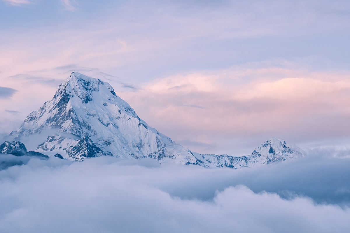
Everest is the most famous mountain in the world. Why? Simply: because it is the highest.
Everest attracts hundreds of climbers each year. They attempt to fulfill a dream. Alongside them, thousands of trekkers travel to Everest Base Camp. To successfully climb Everest requires significant preparation and training, time to acclimatize and prepare on the expedition, and no little expense from travel costs to permits to support.
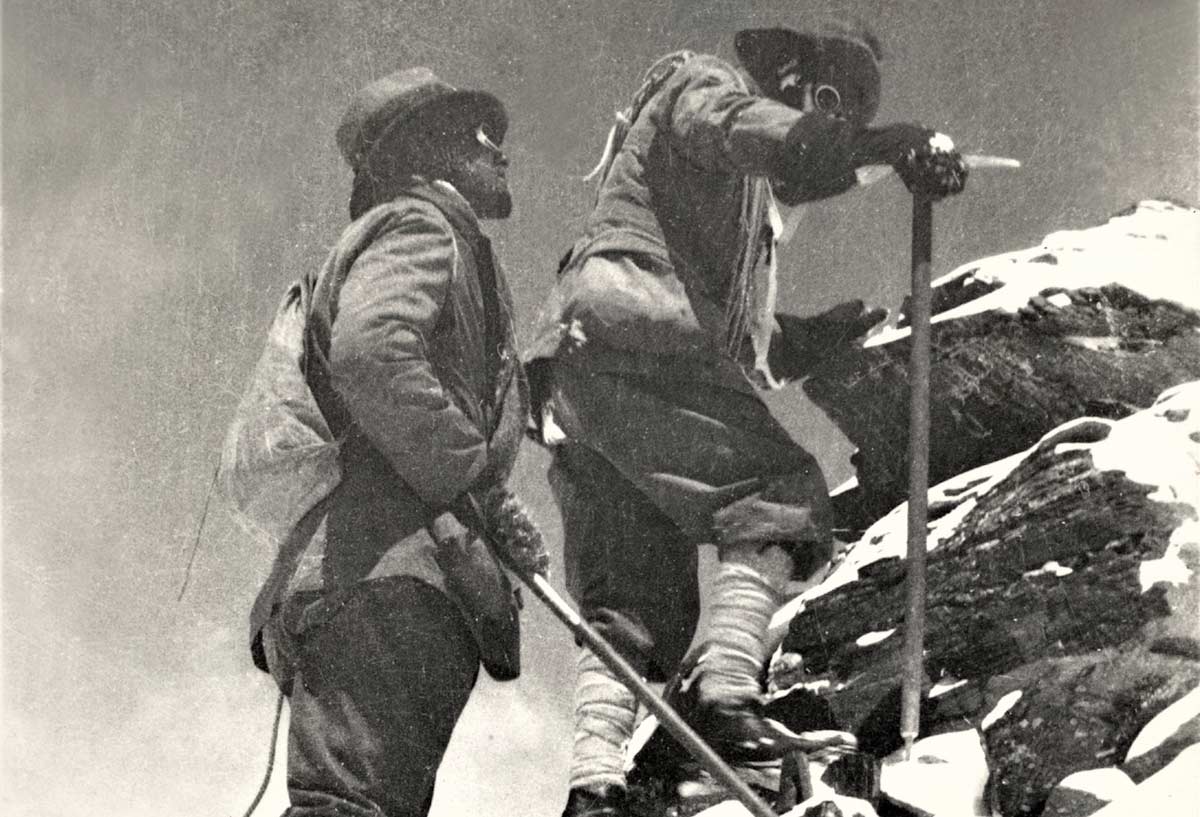
Recently measured at 8848.86m, Everest is located at the border of Nepal and the Tibetan region of China, and was first climbed in 1953 on the south side by a British expedition led by Sir John Hunt, Sir Edmund Hillary and Tenzing Norgay Sherpa.
Since then, and after significant advancements in aspects like first aid, equipment, weather forecasting, oxygen systems and also the commercialization of the expeditions, many attempt to climb Everest on an annual basis.
At the close of the 2024 season there had been a total of 12,884 summits (7,269 different people) since 1953 (counting climbers and their hired support) and a total of 335 deaths since 1923. 9,156 summits had come from the Nepal side and 3,728 from the Tibet side. The death rate for the Nepal side is 1.14% and marginally less at 1.08% for the Tibet side. 64% of deaths have been to climbers on an expedition and 36% to guides. Stats are taken from Himalayan Database and The Blog/Alan Arnette who writes: “Note that two events on the Nepal side represented 21% of the total hired deaths. There were 17 deaths in 2014 when a serac let loose onto the Khumbu Icefall, and ten more died in 2015 when an earthquake created an avalanche that hit Everest Base Camp.” In 2024, nearly 69% of all summit attempts proved successful. 91% of 2024 Summits were from the Nepal side, and just 9% from the Tibet side.
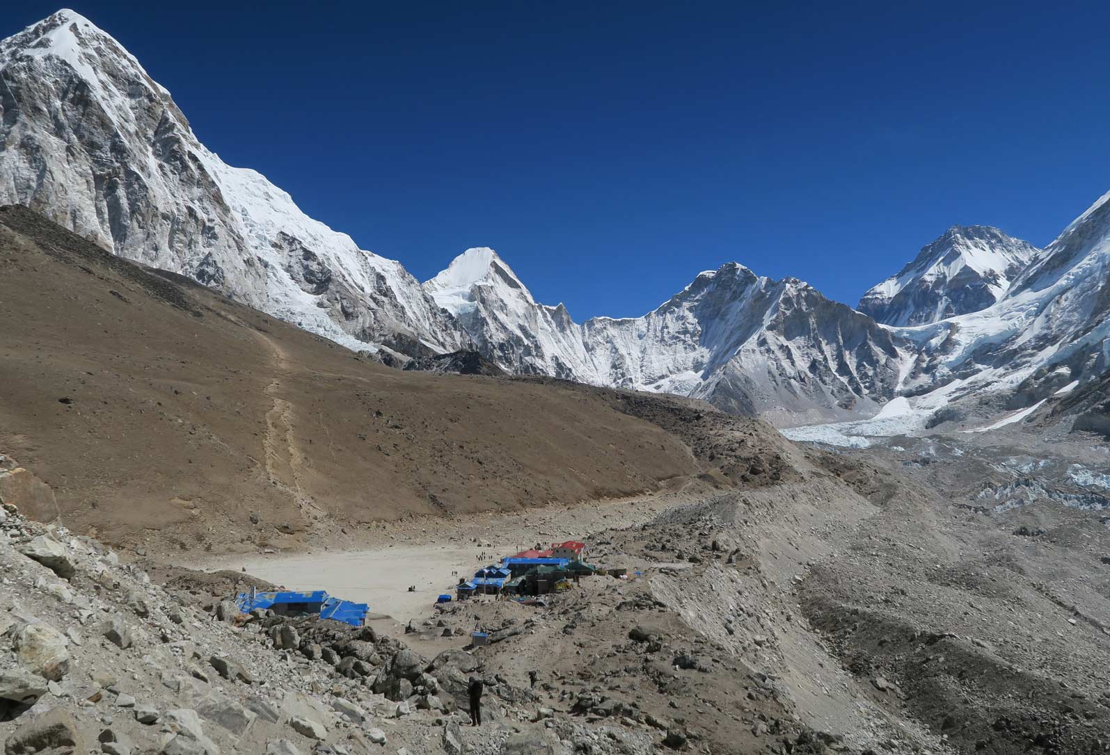
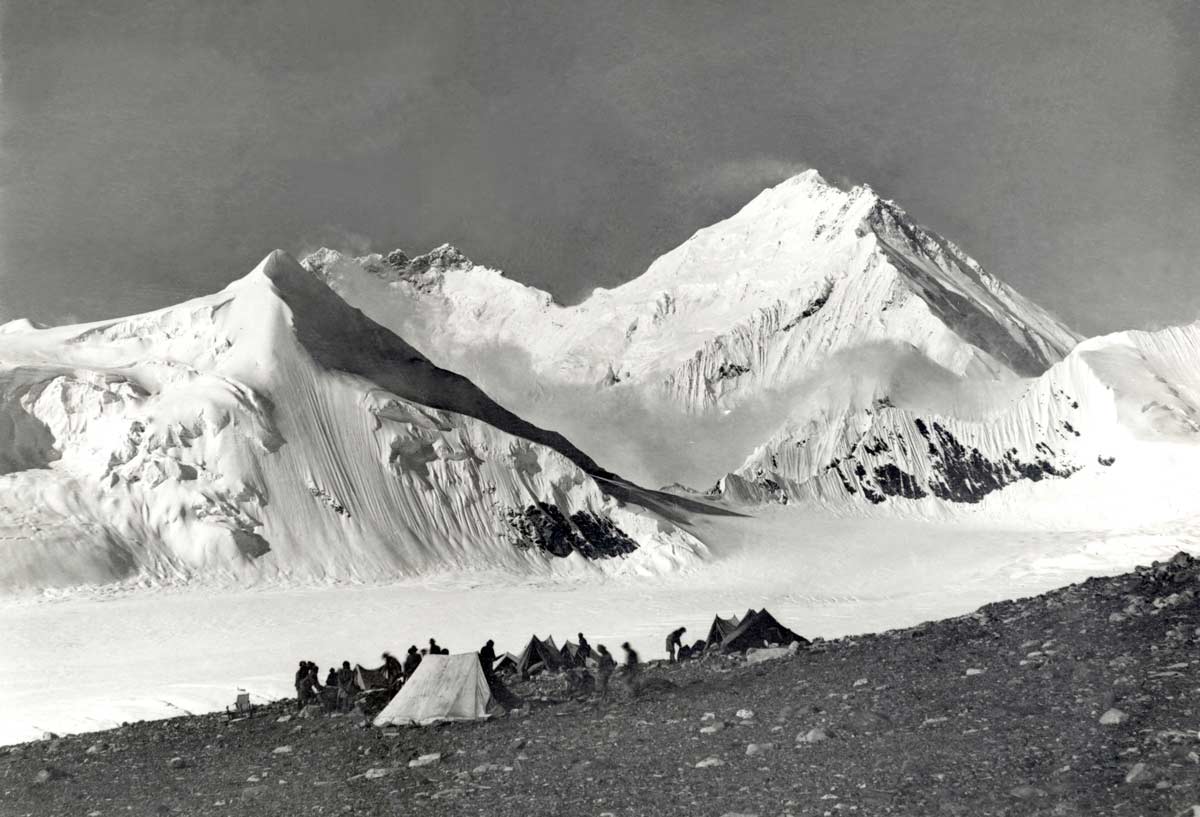
Gorakshep, 5100m
North v South Side
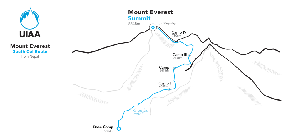
There are two major climbing routes: one from the Nepal side (south), and another from Tibet side (north). Because the south side route is more popular and more accessible, this paper focuses more closely on this route.
North Side
The north side, the Tibetan side, has historically counted for around 30% of all summits. The nearest airport is Shigatse Peace Airport. Lhasa and Chengdu airports are the main airports in the region that connect to Shigatse. It is also the last city that has a hospital and acts as the departure point to the Base Camp in Tingri. In comparison to the south side: in some aspects the north side is easier and in other aspects it is more difficult.
For example, reaching the Base Camp is a lot easier. It can even be done in an off-road vehicle. Another plus is that there is no equivalent of the Khumbu Icefall to negotiate. However, it is also windier, helicopter rescue is not possible and the final summit push is longer and more exhausting. The most difficult part of the climb is the famous Second Step that is located above Camp 4 at an altitude of around 8450m.
South Side
Whether someone is a trekker who just wants to visit Base Camp or somewhere in the Khumbu Valley or has the intention of climbing Everest, the journey usually begins with a flight from Kathmandu to the village of Lukla. The journey takes around 45 minutes. Lukla itself lies at 2750m. As the gateway to Everest, it has good facilities. Flights to Lukla are not always reliable though. On occasions, and sometimes for many successive days, flights may be cancelled due to bad weather or poor visibility. Furthermore, in recent years, flights from Kathmandu to Lukla have been more scarce meaning people have used the alternative method of flying from Ramechhap, a four hour drive from the Nepali capital.
If you are fortunate and your flight arrival time allows, you can begin the first day of trekking on your arrival day. Otherwise, you can stay in one of the many lodgings in Lukla.
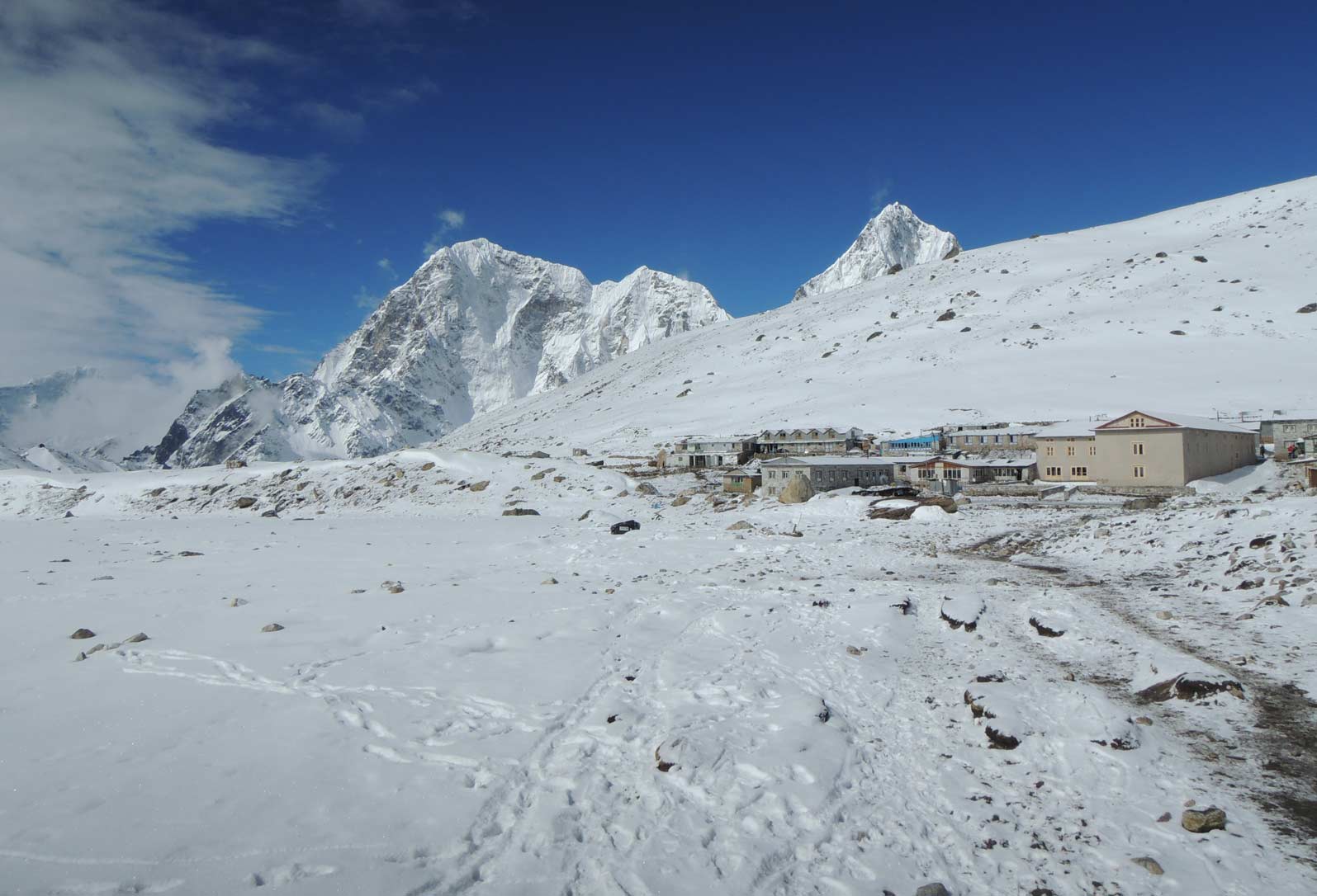
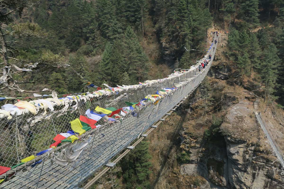
The village of Lobuche (top), trek to Everest Base Camp (bottom left and right)
Trekking to Everest
Base Camp
UIAA Mountain Voices podcast
episode on the present day Everest
The first day of the trek is the easiest day – it is a descent on a well prepared route between various farms. After an hour and some gradual undulation, you pass a number of small villages and different types of Buddhist monasteries. One of the beautiful things to note on route are the different stone etchings of Buddhist mantra that are in complete harmony with the surroundings.
Usually, the first place to stay for a night is Pakkding. It is around three hours and an easy walk from Lukla. It is a quiet, clean village with a small river passing through it. The lodges are well maintained and the food is excellent.
The next target is the famous village of Namche Bazaar. This route can be divided into two parts. The first part is not so steep with a mild elevation gain. In the middle of this section you pass the gate of the Sagarmatha National Park. Here you should register and pay the entrance fee. The path is well prepared and after around three hours walk it is usually lunch time. After this you reach a high suspension bridge (Hillary Bridge). From here the second part of route begins. It is steep with no more teahouses or lodges on route. It takes another three hours to reach Namche Bazaar. This part of the way on a sunny and busy day can be quite unpleasant especially if moles and yaks pass frequently. Inhaling dust is also a big concern.
The magnificent Namche Bazaar is spread up in a semicircle valley from 2600m to 2800m. Once a traditional spot for traders between the north and south, it today consists of lodges, restaurants, bars and shops. Trekkers and climbers usually stay for one or more nights of rest here. You can also walk up to a small village uphill (Khumjung) and enjoy a great view of Everest, Lhotse and Ama Dablam.
From here onwards with increasing altitude, the quality of lodges and accommodation declines, and little by little you enter a different, harsher mountainous environment. Leaving Namche, rhododendron forests appear in the late spring covered by colorful flowers. This is a very nice part of the trip, although going down and up and reaching 4000m height is challenging. If you have enough time, visiting the Tengboche monastery is recommended.
As the altitude increases, hiking is more difficult and the distance you cover in each day becomes shorter. From here the risk of high-altitude related medical problems like AMS are increased and one should be aware of the risk and care about that. Please refer to the dedicated videos – produced by the UIAA Medical Commission – at the foot of this paper.
After covering a relatively short distance you reach Pangboche. This village is home to one of the major Buddhist lamas. Climbers and sherpas on the way to major peaks in this region often visit for a blessing.
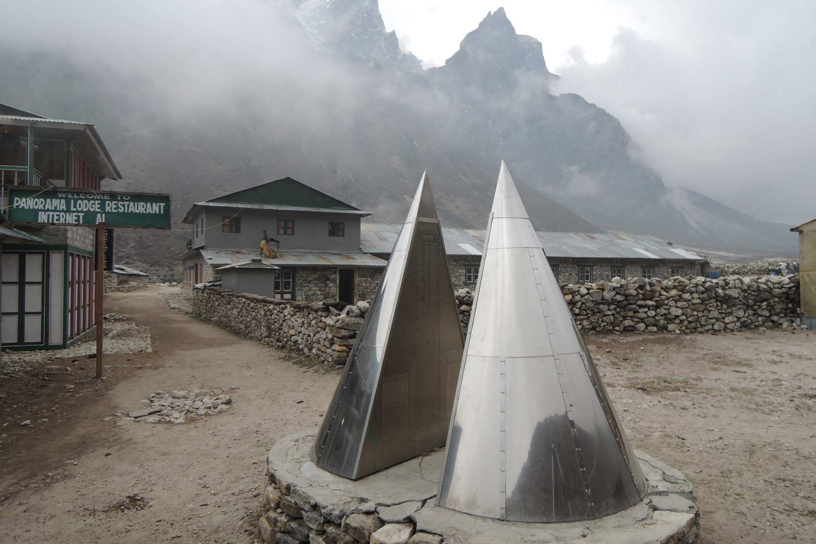
After Pangbouche trekking continues toward Pheriche, a seasonal village of yak herding with multiple lodges at an altitude of 4200m. It is a beautiful but harsh environment, surrounded by giant peaks everywhere. Here there is a high-altitude clinic and a memorial for victims of the mountains. Some people stay here one more day for better acclimatization, and others move up to Lobuche. Just beside Pheriche and before the path gets steeper, you pass a grass plot with some beautiful water springs in the corner. It is the last green area on your journey. After this point the terrain gradually turns to rock and ice. The Himalayan Rescue Association HRA has an aid post here, a well-known institution where a number of UIAA Medical Commission members have visited or worked at for periods of time.
After two to three hours you approach Lobuche Pass. Here you can visit many small to big stone memorials for climbers who died on the Everest and Lhotse, amongst them some famous climbers. After an additional two hours on an easy path, you reach Lobuche at 5000m. In recent years some more modern dwellings have been built. This is the starting point for one of the popular trekking peaks in the region: Lobuche, standing at 6170m. The night is very cold here and altitude problems are common. Ample rest and plenty of fluid intake is crucial.
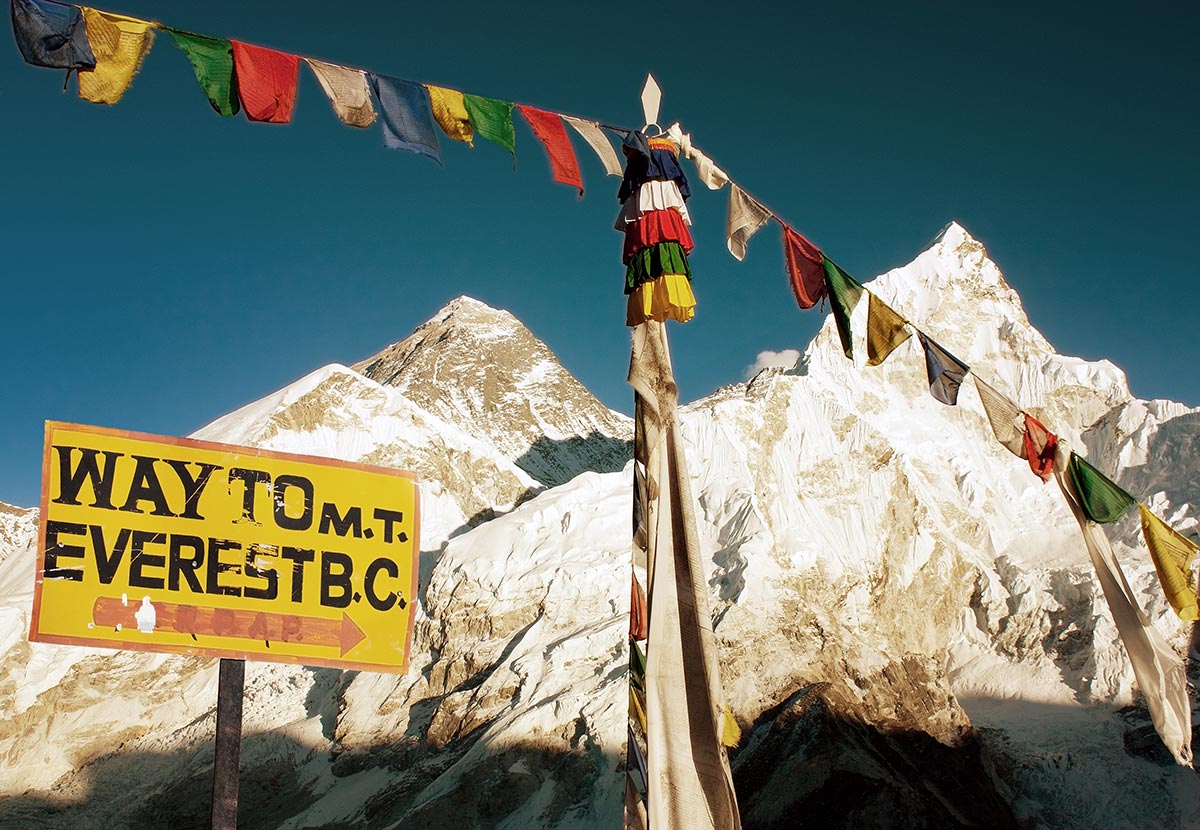
The next stop is Gorakshep at 5100m. With many up and down sections, you pass the side moraine of terminal part of the Khumbu glacier on your right side. On the way to Gorakshep, lies an international research station called Pyramid. This facility is used to study the climate, human physiology, the environment and ecology. After another three to four hours you reach Gorakshep, a flat sandy location. There are some lodges as accommodation but little else. The surroundings are majestic, with Pumori at your left side and Nuptse on the right.
You have two options here:
- If you are in good shape you can climb Kala Patthar and then go to Everest Base Camp. Alternatively one can aim directly for Everest Base Camp.
- Kalapatar is a subsidiary peak in the foot of the Pumori, actually a little hump located over one of the ridges of the Pumori massif. Its height is approximately 5650m. On average it takes two hours. The way is relatively easy and obvious. Here you find one of the best and most famous views of the Everest summit.
From Gorakshep you reach Everest Base Camp in one or maximum two hours. The path is easy but the altitude gain can make it difficult.
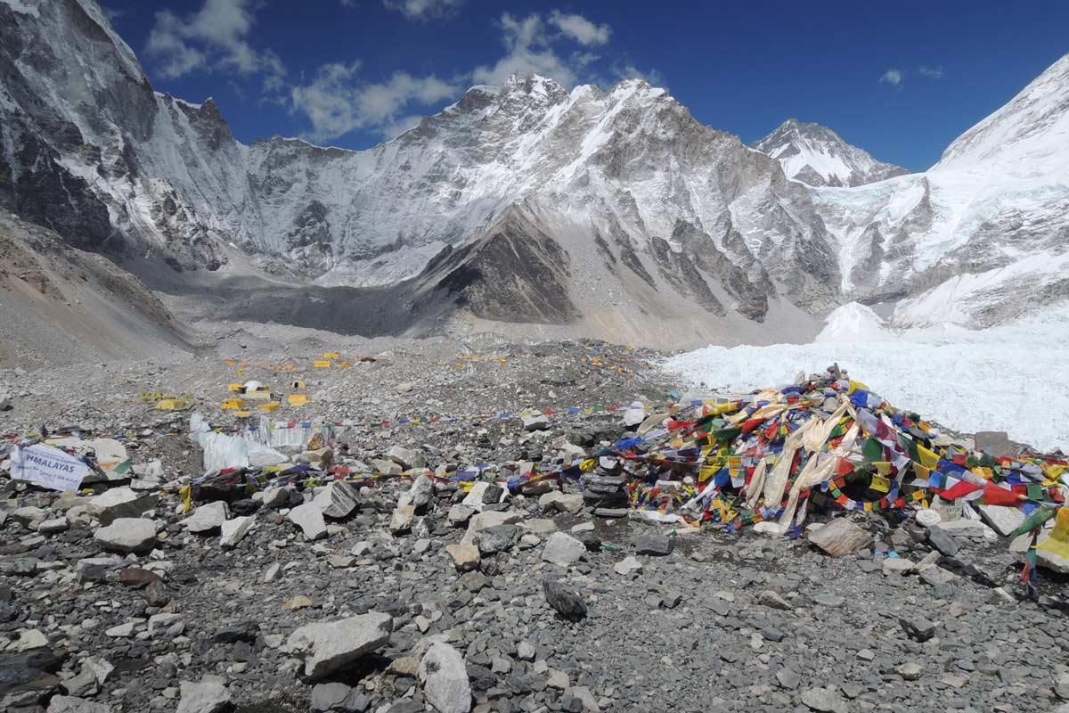
Everest Base Camp (top), Hillary Suspension Bridge (bottom left), memorial in Periche (bottom right)
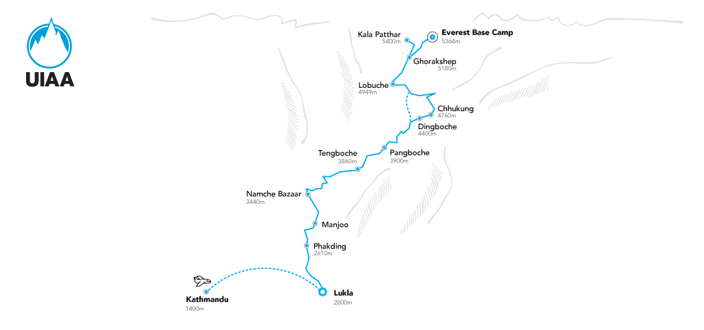
Everest Base Camp
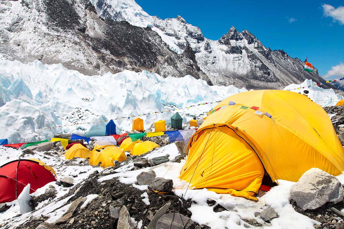
Everest Base Camp (5364m) is located on the Khumbu glacier in the center of a circle that is surrounded by very high mountains.
You enter from the west side of this circle. From left to right you can admire: Pumori, Lingtren, Changtse, Khumbutse, Everest, Lhotse and finally Nuptse to your right side. The Base Camp plateau is over 200m wide and around 1000m in length. During ‘Everest season’ (Northern hemisphere spring), the area is a sea of tents becoming the highest and busiest tent village in the world where more than 1,000 people live for around two months.
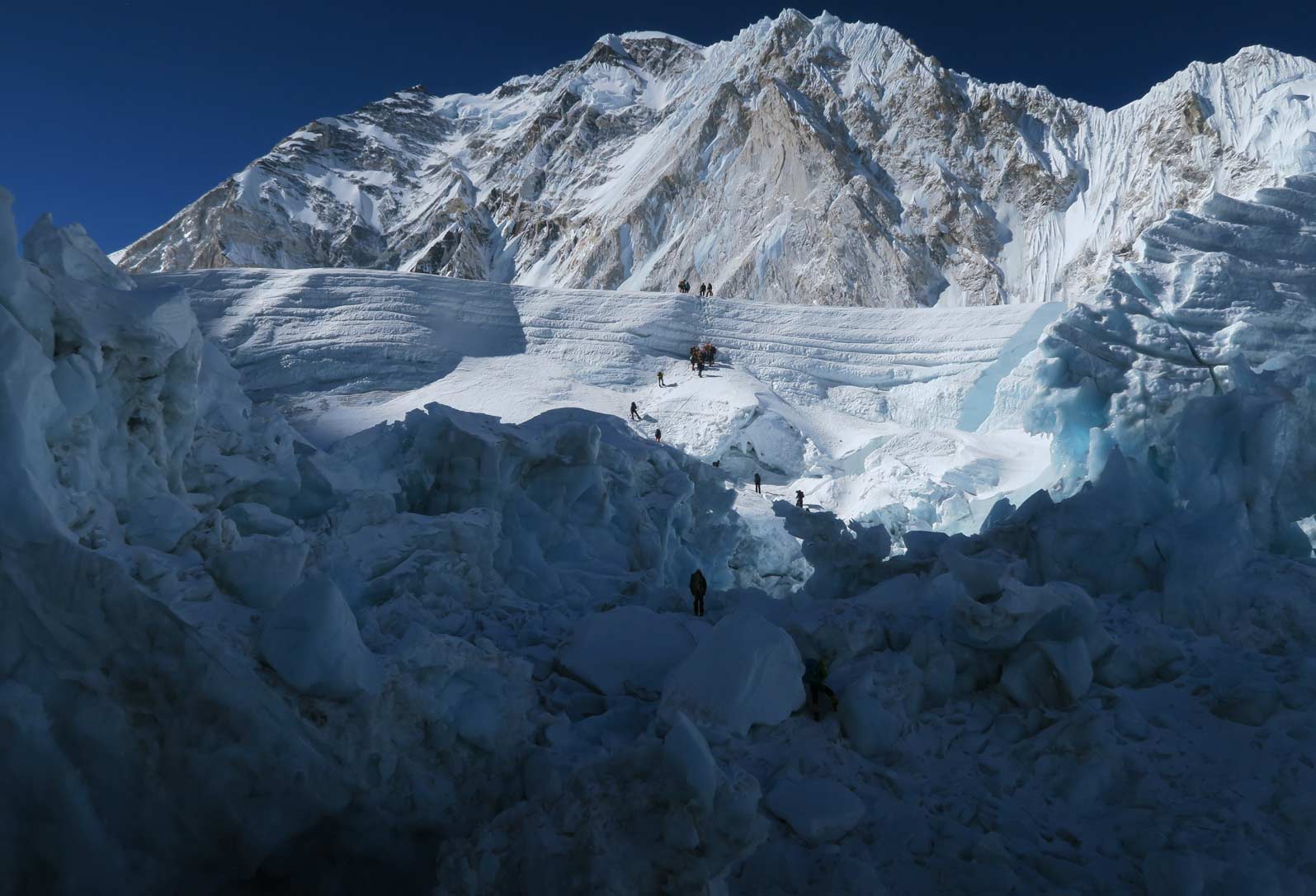
Khumbu Icefall, the gateway to climb to Everest and Lhotse, lies at the southeast corner of that circle.
After a few days’ rest at Base Camp, to get acclimatized and familiar with the environment, you are ready to begin your attempt at reaching a higher camp. The acclimatization step is fundamental.
Khumbu Icefall
One of the most difficult and dangerous parts of the Everest climb is getting through the Khumbu Icefall. Indeed, this is one of the most dangerous sections of any 8000m climb. It consists of thousands of ice blocks of different sizes mounted on top of each other. Some of them the size of a multi-story building. One needs to pass between these blocks to get over and on top of the ice fall. At any moment, one of these blocks can collapse. And it is clear what happens if someone is climbing below that. Also, many large and small crevasses add additional risk to the climb. Some of the crevasses are very large, up to 20 meters wide. And some of them are small enough to cross by simply a wide step or by jumping.
To cross the larger ones, aluminum ladders have been installed by Sherpa. For many years, a number of professional Sherpa secured Khumbu Icefall up to Camp 1 with fixed ropes and ladders to make it safer to climb. These Sherpa are called icefall doctors, and work for the Sagarmatha Pollution Control Committee (SPCC) and the Ministry of Tourism. They maintain and repair the route till the end of the Everest climbing season.
The Khumbu Icefall moves constantly, and this movement makes it unpredictable and everchanging. Every day some parts of it collapse, and some crevasses widen while new ones are formed. In one of the worst accidents in this location 16 Sherpa died in 2014. This was the result of an avalanche triggered on the side of the icefall.
Because of this changing nature of the environment, every time you climb the icefall you face a new section of the route which in some way is different from before, sometimes it gets harder and other times it gets easier. There are very few places where you can rest even momentarily and it is better to cross it as fast and as carefully as possible.
Climbers usually start very early in the morning to ascend before sunshine. Sun makes the icefall more unstable and the risk of avalanche and seracs collapse becomes greater. It takes an average five to seven hours for a normal climber to climb it on their first attempt. Then after one has acclimatized and on subsequent attempts, the pace gets faster.
When you exit the icefall and reach the plateau on top of it, suddenly everything changes. On completing this segment, it is like emerging from a confined space to an open field. The landscape is open and breathtaking.
Khumbu Ice Fall
Camp 1
Camp 1 lies on top of Khumbu Icefall and at the entrance of Western Cwm or ‘silent valley’.
This camp is rarely used – except on the first few acclimatization rotations or in an emergency situation.
It is close to Camp 2. Furthermore, the path to Camp 2 is not steep and is relatively easy when you are in good shape. The difference between the altitude of Camp 1 and Camp 2 is only about 300m. The distance is some 5km.
In some parts you will negotiate crevasses or climb one or two seracs. The area is prone to avalanches from the Nuptse side. The views are great and impressive. With Everest as a huge black pyramid on the left side, Lhotse as a gigantic wall of rock and ice in front, and the Nuptse massif on the right side.
Camp 2
Camp 2 is located at the foot of the Everest pyramid and on the lateral moraine of the Western Cwm glacier.
It is a nice and safe place. It has melting glacial water accessible to use. In recent years many companies have built big camps here with kitchens and staff to serve more clients, and offer a more comfortable stay. Many climbers choose to acclimatize here.
Camp 3
The route up to Camp 3 can be divided into two parts:
- The first is a small and flat section, that goes to the base of Lhotse face. It is not technical and takes one or two hours.
- The second part is the main part. After crossing a crevasse, you enter the Lhotse face: a huge icy flank with moderate slope that in some parts is at an angle of around 60 degrees. It consists mostly of blue hard ice with some intersections of hard snow. However, conditions vary and depend significantly on the season’s snowfall.
In early season, climbers will rely on the anterior points of their crampons. Later in the season it is usually easier to climb it. Because of the repeated attempts of many climbers the footprints are deeper.
In this part the slope continues without any flat sections. It is prone to high winds that sometimes make the climb more difficult. After three to four hours you reach Camp 3. The altitude difference from Camp 2 is around 800m. The location and altitude of this camp is not a single point. It stretches from 7200m to 7400m.
In this area there are many places for tents which are pitched in ice, either side of a fixed rope. Because of its high angle, and blowing winds and high altitude, it is not a comfortable camp to enjoy a proper rest.
But to respect the proper acclimatization process it is a must to stay here for some nights. For climbers who use supplemental oxygen, here can be the starting place to use it.
Nowadays more climbers use oxygen even from Camp 2 onwards and consequently avoid staying at Camp 3 to acclimatize.
Camp 4
The way up to the Camp 4 can be divided into multiple sections.
The first part is steep, you climb directly towards the top of Lhotse glacier. It is around 300m of vertical height, on a moderate slope, like the other part of this flank.
At around 7500m the path turns to the left and there is a big traverse towards the famous yellow band, that is a band of rock, truly yellow in color. It swirls like a necklace from Nuptse to Everest flank. It is made up of limestone.
The yellow band is around 20m high, a vertical mixture of rock and ice with modest technical difficulty to climb it. Other sections on the way towards Camp 4 begin from the top of yellow band, the slope is less steep and consists of hard snow. After a few hundred meters, you reach a bifurcation: the right way goes towards Camp 4 of Lhotse and the left one towards Camp 4 of Everest.
The steepness increases slowly until you reach a rocky part named Geneva Spur. It is not very technical, around 200 meters of rock and ice. After crossing the Spur at around 7800m, a few hundred meters of easy climb take you to the place of camp four: The famous South Col.
This extraordinary place is just a few meters below the 8000m line, at 7980m. In recent years it is usually very crowded in the spring season, in the time of final summit push. During this period, it is called the highest village on earth. This brings some environmental challenges with, across all Camps at Everest, the impact of human waste becoming an increasing problem. Please refer to the mountain protection area of the UIAA website to support initiatives engaged in tackling the waste problem on Everest.
Camp 4 is not a suitable place for a long stay. Climbers usually arrive here six to eight hours after starting from Camp 3, they are quite exhausted. Usually they start their summit push the same day they arrive at Camp 4, after a few hours of rest and rehydration. They prepare a summit push starting at around 21:00 or 22:00.
Centre: Just below the South Summit of Mount Everest
Left: 1924: George Mallory and Edward ‘Teddy’ Norton climbing at 27,000 by Howard Somervell. Supplied by The Alpine Club
Right: 1921: Everest seen from 20,000 camp, last day of the 1921 expedition by Sandy Wollaston
Summit Push
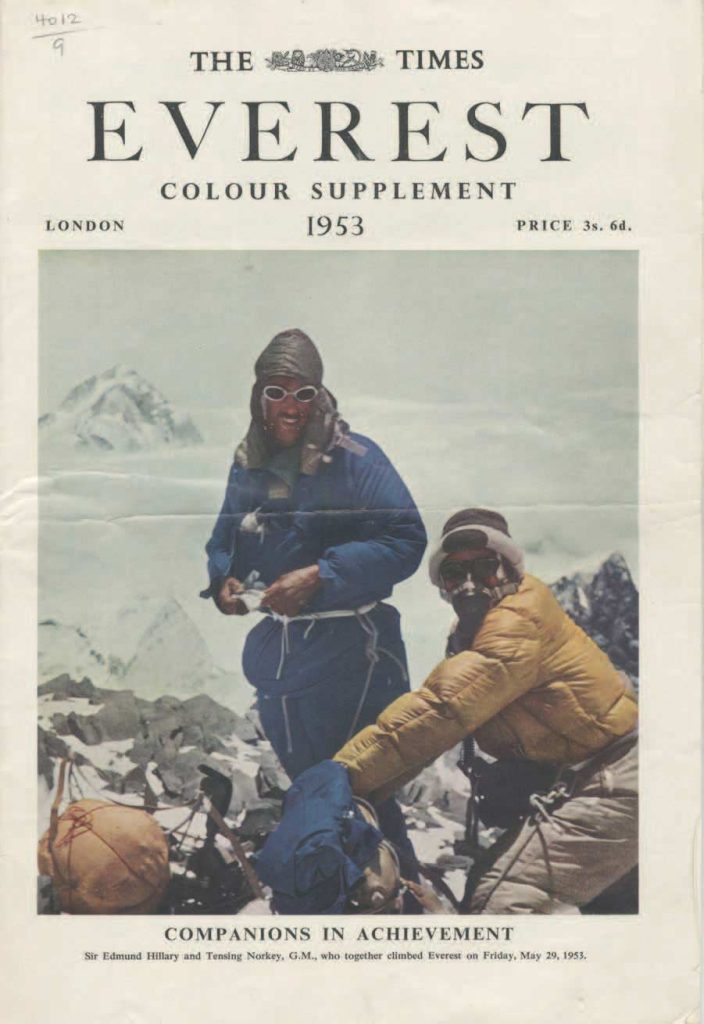
Times of London cover.
Supplied by BALLY
From here on, the so-called “death zone” commences. No acclimatization occurs here. Everything fights against the body and one’s health. The summit push usually begins in the late evening. An altitude gain of 800m needs be covered. The round-trip distance is around 8km.
The initial part from Camp 4 is not steep. You climb on blue ice and after a few hundred meters reach to the foot of the summit pyramid. From here the path is very steep and the average angle is around 50 degrees. It is usually crowded and the queue is long. It can depend on how many climbers are in the line, but the average time for crossing this section is around three to four hours of non-stop climbing.
When reaching 8400m, the steepness becomes gentler and the route turns to the right in a couloir towards the Balcony. This is a hallmark in the summit route and arrives at an elevation of 8500m.
Here there is a relatively small flat area, climbers get some rest and can change their oxygen cylinder for a new one. At this point you have a very good view towards the remaining way up to summit, to the Tibetan plateau and the north ridge, and on the south side toward Lhotse and Makalu and many other smaller peaks of the Solukhumbu region.
After the Balcony the route is again very steep on a mixture of ice and rock, to the right side is the Tibetan plateau and to the left is Nepal. Here lies the border between China and Nepal. It is in this section within the usual climbing window that you encounter the sunrise. Magnificent and brilliant, the darkness lifts and you get warmness from sunshine in your body and in your mind. In the upper section of this part rock dominates and climbing is more difficult although not very technical.
Lhotse lies in the background and Makalu in the left corner. At the end, this part directs you towards a big black rock that can be seen even from Base Camp. Here is the south summit, another hallmark of the Everest climbing route. The altitude is now 8750m.
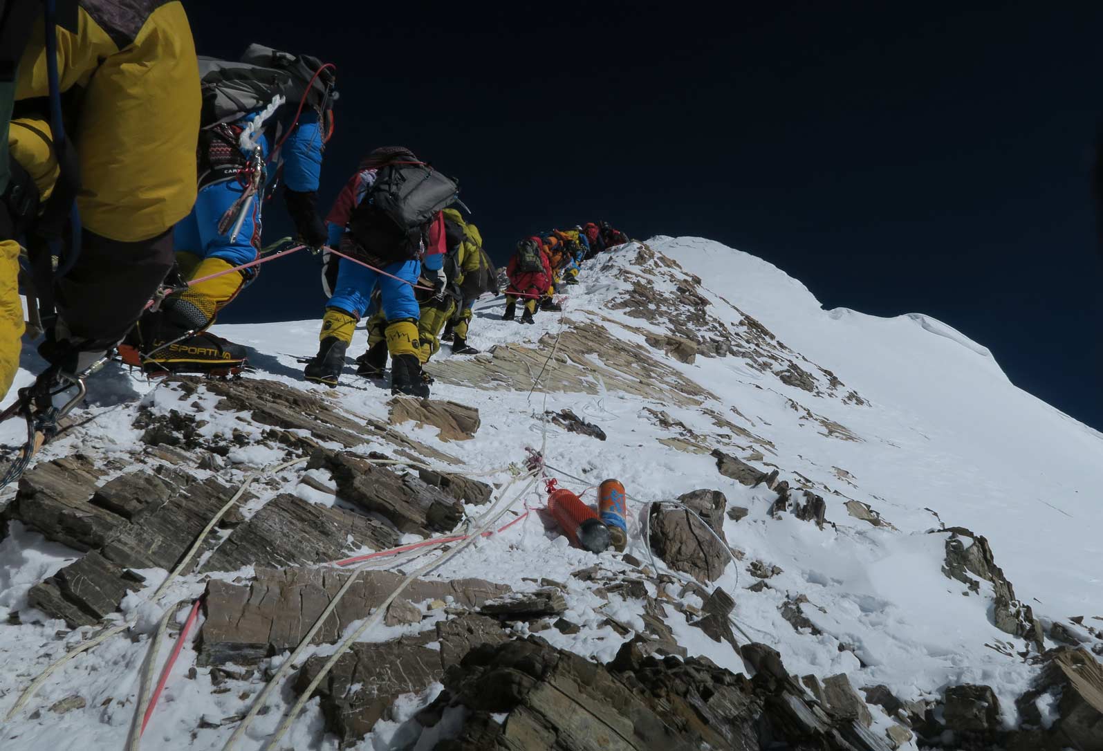
The next part is a horizontal section, called Knife Edge Ridge, because it is sharp and on either side the flank is very steep. It is not very far from the summit, but because of tiredness and the profile of ridge, you need to be extremely careful. It is few hundred meters long, and there is no major altitude gain, but overall there are many short up and down sections on the way. After managing this part, you then climb one of the most famous and important sections: the Hilary Step.
Hilary Step is a 20m vertical mixture of rock, ice and hard snow. It is a quite technical and demanding part of the climb with respect of its location. Its condition depends on how much snow fall there was in the weeks before the climb. Sometimes it consists of harder and easier to climb snow.
This is an issue which has led to climbers stacking in line, and forming heavy queues. This is where some of the infamous photographs have been taken in recent years. This is consequence of the volume of people wishing to take advantage of a short weather window. This is a topic covered in the UIAA Mountain Voices podcast episode dedicated to Everest.
There is only one way to go up or down, and sometimes it takes some hours to cross only this section whether you are ascending or descending. This delay and the length of time at this altitude, is very dangerous. The risk of hypothermia, frostbite and altitude sickness get higher and higher with each passing minute.
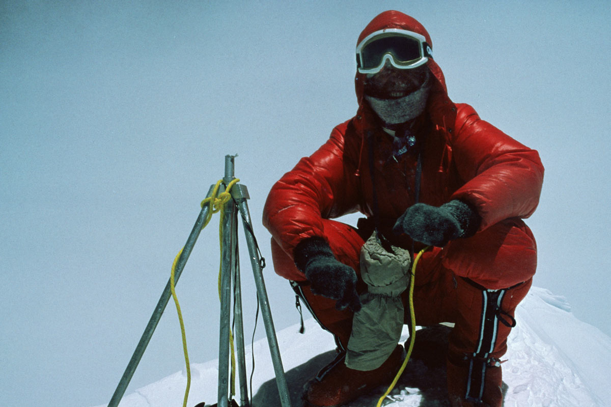
Alternatively to the usual summit approach described above, some climbers decide to start very early from Camp 4. If they pass without getting stuck in this part, they should reach the summit early in the morning, usually in the hours darkness of night. But on their return, they face other climbers who are on their way to the summit. Finishing oxygen reserves is another added risk if the delay is too long. After passing the Hilary Step, there are just a hundred steps towards the summit. It is around 200-300m away. The greatest challenge is now tiredness. A couple of minutes later, the ascent is over and you reach the highest point on Earth.
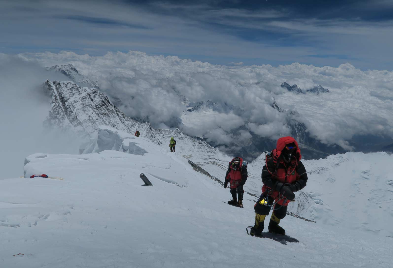
The final steps to the top of the world
The Descent
Descending is the second part of the climb, and maybe the more dangerous one. Most accidents and fatalities occur in this period.
The way down to Base Camp, is the same route as ascending. The exception is the section at the Khumbu Icefall. Because of the continuous movement of ice, risk of serac collapse and widening of crevasse the route changes day by day.
In addition, the weather is warmer and melting of ice causes loosening of pitches and fixed ropes and ladders and need more caution. In many parts of the descent additional fixed ropes are set up to separate the ascent from the descent, but on certain points like Hillary Step, only one secure line is possible, and this sometimes cause dangerous traffic jams.
Climbers usually descend to Base Camp in two days. After the summit they return down to Camp 4 or 3 (and sometimes to Camp 2). And the second day they return to Base Camp.
Acclimatization
Climbing Everest is a unique lifetime experience. It is clearly very challenging and demanding requiring endurance, stamina, fitness, an excellent physical condition and preparation and mental fortitude. Even the trekking part to Base Camp is quite demanding and requires good fitness and preparation. Acclimatization is the key point of any kind of high altitude climbing. It is a must and is an obligation for a safe climb. It is a slow and stepwise procedure that has its own special rules that should not be ignored under any circumstances.
Depending on the altitude of mountain that will be climbed and the condition of the climber it can be shorter or longer.
One of the safest methods of acclimatization consists of at least three rotating periods of acclimatization:
- First stage: up to 6000m and return.
- Second stage: Camp 1 to Camp 2, sleep there for one or two nights and return.
- Third stage: Up to Camp 3 (7300m); sleep there and return.
This is very simplified plan and is suitable for climbers who want to use supplementary oxygen. If climbers want to climb without supplementary oxygen, the process is different. Acclimatization is at a slower rate based on scientific and medical facts.
Although in different people it can be different. Some people acclimatize faster and some find it very hard. It is important to judge your own acclimatization through experience. Another important note is that: above 7500m, you enter the so-called “death zone”. No acclimatization occurs above this level. Your body and mind decay slowly toward death.
Using supplementary oxygen is a little tricky process. Try to exercise at Base Camp before you ascend to high camps. But remember that even if you plan to use oxygen for your summit push or anywhere else on the way up, you need to have acclimatized adequately.
Please refer to the UIAA’s array of medical advice papers and statements not only on HAPE/HACE but on subjects such as hyperbaric chambers and the 2025 statement on the use of xenon in high altitude mountaineering.
Water
Drink good (not excessive) amounts of water during trekking, climbing and even resting days. This helps your health and improve your acclimatization. Drinking enough water is a crucial point in the acclimatization process. Water loss from the body in the mountains (even in the winter) is more severe in its effect on the body than when this happens on a normal day at a lower altitude. Whatever the conditions, we lose a lot of water through our respiratory system.
Keep your body hydrated enough. But this is not very easy in higher camps. The water is usually made by melting ice and snow. Besides the amount of water that is in accessed this way, the quality and taste of that is not good. From the other side, ones’ appetite is low at high altitude, and drinking enough water is not always easy.
The water at Everest Base Camp is provided from small river running from melting icefall. This is also the case in Camp 2. Kitchen staff and SPCC are cautious about the source and hygienic measure of water. This water does not have any kind of mineral qualities. Adding some kind of edible powder to change the taste and make it more palatable can be a good solution. This is also helpful in providing the body with enough minerals.
When preparing your own water to drink and use for cooking, please refer to the UIAA advice video on water disinfection.
Essentials
Language
Nepalese, English
Local Currency
Nepal rupees
Visa Requirements
Easily available from a Nepali embassy or on arrival to airport. www.ntb.gov.np
Permits
Permits are required both to trek to Everest Base Camp (including the Sagarmatha National Park Entry Permit) and to climb Everest itself.
The current permit prices for Everest are available on the Tourism Department of the Government of Nepal website.
There are also a significant number of rules enforced including being accompanied by a local guide at all times (no solo climbs) and having previously summited a 7000m peak before attempting Everest.
Further information will be provided by your chosen expedition company.
Evacuation
Helicopter support and evacuation is available by private agencies. Sometimes evacuation is possible from as high as Camp 3. Sherpa support and human based search and rescue is available in season
Hospitals
Lukla district hospital, limited services
Communication
Up to the Base Camp mobile network is available. Thuraya satellite service has good coverage. Internet is also provided by some big companies at Base Camp.
Climbing Season &
Conditions (In Brief)
Base Camp altitude is 5345m. Early in the season it is can be very cold at night. It gets warmer when closer to late season. High camps are always very cold and windy. Temperatures of minus 20 degree Celsius or more is expected in the summit push night from Camp 4.
The weather usually becomes more stable across the climbing season although short-term storms are possible and sometimes heavy snow falls occur.
Good weather for the summit push usually arrives around mid-April onwards. Sometimes this window is very short, no longer than one week
Dangers
Dangers have been identified throughout this paper.
In short, every kind of danger that may occur in a climbing activity and in a remote place, is possible in the Everest region.
From climber’s side: conditions like altitude sickness to HAPE, HACE, hypothermia, frostbite.
From the mountain’s side: avalanches, rock falls, crevasses.
Please refer to specific advice from the UIAA’s library of high-altitude medical papers
https://theuiaa.org/mountain-medicine/mountain-advice/
Clothing
Proper clothing is crucial to safety and success. In terms of footwear, good quality climbing boots are enough. The modern climbing boot with a pair of good socks keeps the foot warm and protected enough. Avoid making your foot too tight by wearing extra layers of socks. Very loose or in contrast, tight shoes make the foot more vulnerable to frostbite and other injuries.
Sun Protection
Sunshine is potent in the mountains. As you go higher it gets stronger. Even on cloudy days there is enough ultraviolet rays to burn your skin. Use of good and powerful sunscreen is crucial in all part of trekking and climbing. Snow blindness is another risk of high altitude expedition.
As mentioned, ultraviolet light is very strong. The burning of the surface of cornea can result in snow blindness if climbers don’t wear proper sunglasses. Sunglasses should be fitted completely over the face and have protection from the side of frame and prevent the reflecting rays enter the eye from below and sides. The lens should be category 4.
For the summit day or stormy condition in high camps, use of goggle frames is logical. Frostbite and hypothermia are real dangers in Everest or any other high mountain.
Environmental Considerations
and Mountain Protection
The UIAA is committed to the protection of the mountain environment and has been since its founding in 1932. The UIAA Mountain Protection Commission was formed in 1969. Today the UIAA spearheads a number of projects related to sustainability in mountain regions including its annual Mountain Protection Award, through the work of its Climate Change Taskforce and its many international partnerships. For further details, please visit: https://theuiaa.org/mountain-protection/
The UIAA encourages all climbers and mountaineers to consider their carbon footprint and adhere to local regulations and customs once on the ground. Everest, in particular, is often cited as one of the worst examples of human pollution and waste in mountaineering. Please visit the UIAA Mountain Protection Award website for information on projects trying to rectify this and improve conditions in the future.
Featured News
Credits
Lead Author – Alireza Behpour
Images – unless otherwise stated are courtesy of Alireza Behpour and stock libraries
All text and content is reviewed by a dedicated working group within UIAA Medical Commission. Discover more here.